The star map wedding gift is worth the money only when the chart printed is the sky the software actually computed for that latitude, that longitude, and that minute. In most cases, it isn't. The dial is decorative, the date is typographic, and the constellations are stock art rotated to look convincing. We know because we plot before we draw. The difference between a real chart and a printed dial is the difference between Vega at magnitude 0.03 genuinely rising over the reception hall and a generic swirl of dots that has never stood over anywhere.
Why the "Sky That Night" Star Map Is Actually a Good Wedding Gift
Let us make the case for the genre in its strongest possible form, because it deserves that hearing. The idea is quietly excellent. A wedding is a coordinate — a place on the ground, a moment on the clock, a hemisphere tilted a certain way toward a certain slice of the galaxy. The sky above that coordinate is, in the strict sense, unrepeatable. Every one of the ten trillion possible weddings this year has its own configuration of stars overhead, and the configuration is not a metaphor. It is a solvable problem in spherical astronomy. Give the software a latitude, a longitude, and a timestamp and it will return the answer with more precision than the couple will ever need.
That is what makes the gift work at its best. Unlike almost every other object exchanged at a wedding, a genuine star chart of that hour is not decorative shorthand for a memory. It is a receipt. Arcturus at apparent magnitude -0.05 was where the HYG catalogue says it was, high in the eastern sky of a June evening in the Northern Hemisphere or grazing the horizon of a Southern one. Vega at 0.03 was climbing or setting according to the same laws that let a navigator in 1780 find longitude at sea. The chart, if drawn honestly, is a document. Two hundred years from now, a descendant with any competent planetarium program can recompute the same sky from the same coordinates and get the same answer, star for star.
There is also something quietly correct in the choice of stars as the medium. Human faces change, buildings come down, cities rename their streets, but the six brightest stars in our grounding — Sirius, Canopus, Arcturus, Rigil Kentaurus, Vega, Capella — will occupy essentially the same places, to the naked eye, for the entire lifetime of anyone reading this and their grandchildren. Precession will nudge the north celestial pole across the sky over millennia. The stars themselves will not visibly drift within a human generation. The gift, in principle, is durable in the way a photograph is not.
The trouble is that almost nothing sold as a "sky that night" star map is actually the sky that night.
Where the Sentiment Stops Being a Map
Now the concession has been paid, and we can look at the product honestly. Open a browser tab, type "custom star map wedding gift" and click through fifteen of the top listings. Then compare what the storefronts promise to what the artwork actually shows. The gap is systematic, and it is not innocent.
First failure: the magnitudes are wrong. In a real chart, Sirius at apparent magnitude -1.44 is drawn dramatically larger than Vega at 0.03, which is in turn drawn larger than a fourth-magnitude filler star. That size difference is the magnitude scale doing its job — a logarithmic ranking of brightness that lets a chartmaker convey, on paper, what the eye sees at night. On most commercial star map prints, every star is drawn the same size, or the "size" variation is a decorative flourish uncorrelated with any catalogue number. The chart lies about the sky by flattening it.
Second failure: the stars visible are frequently impossible from the stated location. Canopus sits at declination roughly -52.7 degrees. It cannot be seen from a wedding held in Boston, or London, or Warsaw, or anywhere north of about latitude 37 degrees, and even there it barely clears the horizon. Rigil Kentaurus, at declination -60.8 degrees, is invisible to essentially the entire Northern Hemisphere audience. Yet templated star maps sold to Northern couples routinely include the entire celestial sphere as if the ground did not exist and the horizon were a suggestion. A chart that shows stars beneath your feet is not a chart of your sky. It is a decorative wheel.
Third failure: the time is often typographic. A real computation asks for date, time, and time zone with the seriousness of an air traffic controller, because the sky rotates through fifteen degrees of right ascension every hour. A wedding at 6:00 pm and a wedding at 8:00 pm on the same evening in the same city show meaningfully different skies — different stars near the meridian, different constellations climbing in the east. The "personalization" on most star map storefronts changes the date on the caption and rotates the artwork by an angle that looks plausible. It does not recompute the sidereal time. The output is a rotated stock image with a new label.
Fourth failure: the constellation lines are stylised past the point of recognition. Real constellation boundaries were fixed by the International Astronomical Union in 1930 as eighty-eight non-overlapping regions of the sky. The stick-figure lines connecting bright stars within each region are a separate cultural artifact — sometimes drawn from Greek tradition, sometimes from Arabic naming, sometimes invented by nineteenth-century atlas publishers. Neither the boundaries nor the stick figures are optional artistic choices in the way many prints suggest. Redraw them however the aesthetic demands and you have made a poster, not a chart.
Fifth, and this is the one that matters most: the chart does not know what the sky was actually doing that night. Was the couple's wedding at civil twilight, with only Sirius and Canopus and maybe Capella yet visible above a still-blue sky? Was it deep night at 11 pm with the Milky Way arching over the reception? Was it a full-moon evening that washed out everything below third magnitude? A real chart honours those conditions. The templated print pretends every wedding happened at astronomical midnight on a moonless plain.
The Rule We Use in the Studio Instead
When we take on a commission of this kind, the plot precedes the print by a wide margin. We ask for six numbers, not two. Latitude to at least four decimal places, longitude the same, date, local time, time zone offset from UT, and the elevation of the horizon if there is a mountain or a treeline that matters. Those numbers feed a sidereal time calculation, which fixes exactly which part of the celestial sphere is overhead at the requested moment.
Then we filter the star catalogue. The HYG database — the union of Hipparcos, Yale Bright Star and Gliese, from which our six anchor stars are drawn — is the working ground truth for anything visible to the unaided eye. We cull it to whatever is genuinely above the local horizon at the requested instant, and then to the magnitude limit the print resolution can honestly show. A poster at typical living-room viewing distance can distinguish maybe six magnitude classes cleanly; beyond that the dots become indistinguishable from noise.
Then the projection. A stereographic projection centered on the local zenith gives a circular chart in which the horizon is the outer edge and the point directly overhead sits in the middle. This is the projection most planetarium software defaults to for a reason: it preserves the recognisable shapes of constellations near the center and stretches only the region near the horizon where the atmosphere would blur things anyway. Rectangular equatorial projections make beautiful atlas plates and terrible wedding gifts, because they do not correspond to the way any human being looked up on the night in question.
Only then do we draw. Sirius at -1.44 gets the largest dot on the plate. Canopus at -0.62, if the wedding was in Sydney or Cape Town or Buenos Aires, sits below and to the west with the second-largest. Arcturus at -0.05 and Rigil Kentaurus at -0.01 are indistinguishable to the naked eye at magnitude, and we draw them so — the same size, distinguished only by position. Vega at 0.03 and Capella at 0.08 come next. The reader who knows the sky will look at the chart and recognise it. That is the test. If a chartmaker with a copy of the HYG catalogue, given the same six numbers, would produce a plate that overlays cleanly on ours, we have made a map. If not, we have made a poster of a map.
Constellation lines, we draw from the IAU boundaries and label the stick figures with the tradition their names come from. Greek where the myth is Greek. Arabic where the star name is Arabic — which is most of the individual proper names in the northern sky, including several that look Latin at a glance. Southern navigators' constellations where the sky under discussion is southern.
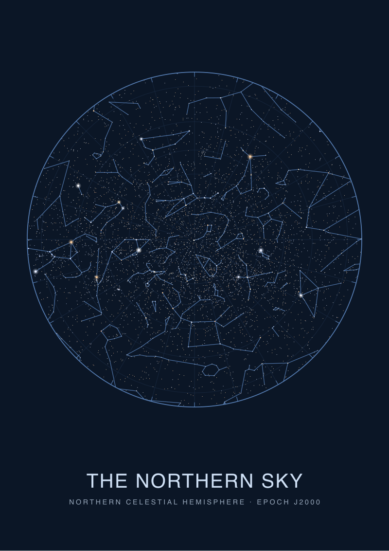 The Northern Sky
The print from this article · from €29.95
View the print →
The Northern Sky
The print from this article · from €29.95
View the print →
When the Old Rule Still Wins
None of the above matters if the couple does not want a chart. Some people want a talisman, and a talisman is not obliged to survive audit. If the gift is understood on both sides as a symbol — the idea of the stars that night, rendered decoratively — then a stock celestial wheel with a nice date caption is doing exactly the job it was hired to do, and the chartmaker's objections are pedantry. The failure mode is only real when the buyer thinks they are getting a computation and the seller is delivering an ornament without saying so. Buy the ornament with clear eyes, or commission a chart from a studio that plots before it draws — the shop at see the The Northern Sky print exists for the second case — and either way the wedding is well served. What we object to is the third path, where the price is paid for the chart and the picture is of the poster.
From the collection
New charts and 10% off your first print.
One email now with your code. No noise after.