Alsephina sits at magnitude 1.93 in the constellation Vela, at right ascension 8.74506 hours and declination minus 54.70882 degrees in the HYG v41 catalogue. Those four numbers are the entire raw material a star map needs. Everything that eventually appears on a printed chart — the diameter of the dot, its position on the paper, the label sliding off to one side, the faint gridline running behind it — is a decision made downstream of that single record. The question of how the map is drawn, and what each detail actually means, depends entirely on who is holding the chart and what they came to it for.
We get the same question in three very different tones, and it deserves three very different answers. So rather than pretend one description fits all readers, we are going to walk through three hypothetical people looking at an Alsephina chart, and ask what each of the marks on the page is doing for them. Imagine, in turn, a first-time buyer of a print, an amateur observer with binoculars in a dark field, and a chartmaker at a desk with the raw catalogue open. The same star. The same four numbers. Three completely different maps of meaning.
Scenario 1: The Reader Holding an Alsephina Print for the First Time
Picture a reader unrolling a framed print of the sky around Alsephina for the first time. They have never opened a star catalogue. They may not know that Vela is the Latin for "the sails", the fragment of the old ship Argo Navis that the International Astronomical Union kept in its 1930 division of the sky. What they see is a dark rectangle, a scatter of white dots of different sizes, some labels in a quiet serif, and a slightly brighter dot with the word Alsephina written next to it.
The first question they ask, usually silently, is which dot is the star the map is named for. The answer is encoded in size. On our prints, the diameter of a dot is a monotone function of magnitude — brighter stars are bigger circles — and Alsephina at magnitude 1.93 is drawn roughly at the size we reserve for stars between 1.5 and 2.0. That is not a decorative choice. It is a translation of the ancient magnitude scale, in which each whole step corresponds to a brightness ratio of about 2.512, into a diameter ramp that human vision can read at arm's length. Let us say the reader is standing 60 centimetres from the wall. At that distance, the dot they are looking at needs to be around 3.4 millimetres across for the eye to register it as clearly brighter than its neighbours without dominating them. Every design decision, from paper stock to ink weight, reinforces that ranking.
Their second question is what the label is doing. The label reads Alsephina, not Delta Velorum, not HR 3485. That is a curatorial choice. Alsephina is the IAU-approved proper name, formalised in 2018, drawn from the Arabic al-safīnah, "the ship". Delta Velorum is the Bayer designation, still used by observers who prefer Greek letters. On a print destined for a wall, the proper name almost always wins, because it carries the story. If the reader ever wants to look up more, the Bayer designation is what unlocks the technical literature; we sometimes tuck it into a lower-right key so both can travel together.
The third question is quieter, and often unspoken: what is the ghost grid in the background? Those are lines of right ascension and declination — the sky's own coordinate system, measured in hours across and degrees up and down. Our reader will never do arithmetic on them. For them, the grid is scaffolding, a faint reassurance that the star is where the map says it is. That reassurance is the entire point of printing it at all.
Scenario 2: The Amateur Observer Cross-Checking a Southern Chart
Now imagine a different reader entirely. Let us say an amateur observer in Chile, standing on a farm road at 2 a.m., binoculars around the neck, a small red torch in hand, and a printed chart of the Vela region held flat against a clipboard. They already know the sky. What they need from the map is confirmation, not introduction.
For them, the same dot means something much more operational. Alsephina at magnitude 1.93 is a naked-eye star in a dark rural site, comfortably brighter than the informal magnitude 6 limit of unaided vision. It is a signpost, not a target. The observer is using it to hop to something fainter. The map's job is to place that signpost with enough angular accuracy that a mental line drawn from it to the next star lands where the next star actually is. Right ascension 8.74506 hours and declination minus 54.70882 degrees translate into a very particular spot on a projection — usually a stereographic or gnomonic one, chosen so that short straight-line hops on paper correspond to short great-circle hops in the sky. Get the projection wrong, and by the time the observer has hopped three stars away, the line is off by half a binocular field.
The label matters differently here. Alsephina as a name is fine, but the observer may quietly translate it back to Delta Velorum, because their planetarium software indexes objects by Bayer designation. The magnitude number, if it is printed, is not decoration — it is a check. If the observer sees a star that looks brighter than the printed magnitude 1.93, they are probably not looking at Alsephina; they may have drifted onto Suhail (Lambda Veloris) or Markeb (Kappa Velorum), both nearby, both similarly luminous to the naked eye, both easy to confuse in the deep southern sky.
The grid in the background stops being ghost scaffolding and starts doing work. Every ten-degree interval in declination becomes a distance ruler; every hour of right ascension is a rough angular measure across. Alsephina's declination of minus 54.70882 degrees tells the observer that from mid-southern latitudes, this star will pass nearly overhead, and from anywhere north of about 35 degrees latitude, it will never rise at all. That is why they are in Chile with the chart and not in Madrid. The map, read this way, is a set of promises about geometry. Miss on any of them and the observer's night stops working.
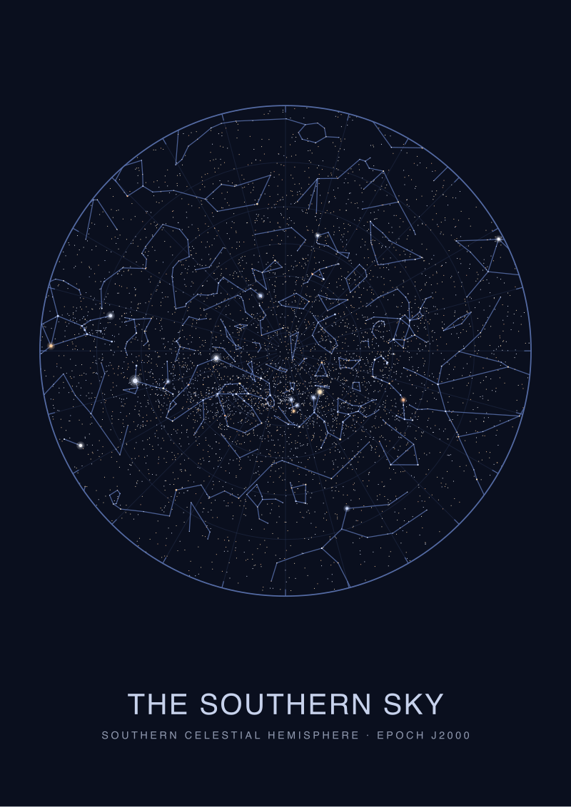 The Southern Sky
The print from this article · from €29.95
View the print →
The Southern Sky
The print from this article · from €29.95
View the print →
Scenario 3: The Cartographer Plotting Alsephina From the Raw Catalogue
Now picture the person who made the map. Imagine a cartographer at a wide desk, with the HYG version 41 catalogue open in one window and a vector drawing environment in another. They have never seen Alsephina with their own eyes; from where they work, the star sits too far south to rise. Their contact with it is entirely through the record: name Alsephina, constellation Vel, apparent magnitude 1.93, right ascension 8.74506 hours, declination minus 54.70882 degrees, catalogue source HYG v41.
The first thing they do is convert. Right ascension in decimal hours (8.74506) becomes an angle in degrees by multiplication by fifteen — about 131.176 degrees along the celestial equator. Declination is already in degrees. Those two angles are then run through whichever projection has been chosen for the sheet: for a print centred on Vela, we tend toward an azimuthal projection anchored on a point inside the constellation, so that great-circle distances near the centre distort minimally. The projection produces a pair of paper coordinates in millimetres from the sheet's centre. That pair, and nothing else about Alsephina's position, is what the plotter uses to place the ink.
Magnitude then decides the mark. Our internal ramp is not linear. Because the eye responds to brightness on something closer to a logarithmic scale, we map magnitude to diameter with a shallow exponential curve, calibrated so that a magnitude 0 star and a magnitude 5 star look plausibly different without the brightest circles swallowing their neighbours. Alsephina at 1.93 lands almost exactly in the middle of that curve. On a 40-by-50 centimetre print, that resolves to a dot of a specific size, printed in an ink weight chosen to hold its edge under gallery lighting without bleeding into the paper's warm base tone.
The label placement is a separate small problem. Alsephina cannot sit on top of the dot without obscuring it. Our convention is to place labels at a set offset, and then let a collision-avoidance pass shove them out of the way of neighbouring stars, of gridlines, and of the constellation figure lines that we sometimes draw. For Alsephina, the label almost always ends up to the lower right, because Suhail sits above and to the east and the constellation figure of the sails runs to the upper left.
Finally there is the question of what not to draw. HYG version 41 contains an enormous number of stars — many, many fainter than the human eye can see from a dark site. We cull. For a Vela print aimed at a general audience, our practical floor is somewhere around magnitude 5.5, which is roughly the naked-eye limit under decent conditions. Alsephina, at magnitude 1.93, survives every possible cull. That is the privilege of a bright star: it is never in question. Everything faint is a curatorial decision.
What All Three Readings Share
All three readers — the first-time print buyer, the southern-field observer, the cartographer at the desk — are looking at exactly the same four numbers. Name Alsephina. Magnitude 1.93. Right ascension 8.74506 hours. Declination minus 54.70882 degrees. The map does not know which of them is holding it. What differs is what the marks are being asked to do.
The consistency underneath is the point. Because the underlying data is a single record from a public catalogue, the print, the observer's chart, and the cartographer's plot all agree with each other. If the print says Alsephina is a certain distance and direction from Suhail, the observer will find that same distance and direction in the field, and the cartographer's math will predict exactly that offset. A star map that fails this test — where the mounted print and the field chart disagree — has smuggled in a decision somewhere and hidden it from the reader. Ours try very hard not to.
The other thing all three share is a hierarchy of trust. The catalogue is trusted absolutely, within the tolerances the catalogue itself declares. The projection is a chosen distortion, honest about being one. The magnitude-to-diameter ramp is an editorial convention, disclosed if the reader asks. The label placement is craft. The grid is scaffolding. When any of those layers gets confused with any of the others — when a craft choice starts to feel like a fact, or a fact starts to feel like a choice — the map has begun to lie.
Which Scenario Is You
If you are reading this because a printed Alsephina map is coming into your house and you want to understand what you are about to hang, you are the first reader, and the only detail you need to keep in mind is that dot size means brightness, not importance. Alsephina is drawn the size it is because in the sky, at magnitude 1.93, it looks the size it does relative to its neighbours.
If you are reading this before a night in a dark southern site, you are the second reader, and the details that matter to you are the projection and the coordinate grid. Alsephina's declination of minus 54.70882 degrees tells you where in the sky to expect it; the projection tells you how far the paper lies about that expectation as you move away from the centre of the sheet. Trust the centre. Verify the edges.
If you are reading this because you are considering making your own charts, you are the third reader, and the discipline is to draw nothing you have not decided to draw. Every ink mark on a good star map answers to a specific number in a specific catalogue, or to a stated editorial rule about how numbers become marks. Alsephina, at magnitude 1.93 in Vela, is one of the easy ones. The rest of the sheet is where the craft actually lives.
The number on the chart is 1.93. What that magnitude decides is not the star's importance to the sky, but the size of the ink and the weight of the label — and those two decisions are the entire difference between a map that reads as a picture and a map that reads as a claim about where things are. Choose the map, and you have already chosen which reader you want to be.
From the collection
New charts and 10% off your first print.
One email now with your code. No noise after.