Alkaid sits at right ascension 13.79235 hours and declination +49.31327 degrees, with an apparent magnitude of 1.85 in the HYG v41 catalogue. Those three numbers are the whole brief. Everything else on a star map of Alkaid — the size of the dot, the line to Mizar, the graticule around it, whether the label sits above or below — is a decision the chartmaker makes about how to render them. This piece walks the decisions in order, as a flowchart in prose. We will ask three questions. Each answer routes the map somewhere different.
Question 1: Do You Want the Star Where It Is, or Where It Looks?
This is the first fork because it decides which coordinate system the chart is built on. The HYG catalogue gives Alkaid at RA 13.79235h, Dec +49.31327°. Those numbers are catalogue coordinates — mean positions referred to a standard equinox, cleaned of atmospheric distortion, aberration, and the small annual wobble every star performs against the reference frame. They are where the star is in the ledger.
But a reader outdoors on a given night is not looking at the ledger. They are looking through several kilometres of atmosphere at a moving Earth, from a specific latitude, at a specific hour. The star they see is shifted from the catalogue position by refraction near the horizon, by precession over the years, and by proper motion over the centuries. For Alkaid, near +49° declination, precession alone moves the catalogued point by roughly a degree over a human lifetime.
A chartmaker has to pick one.
If You Want the Star Where It Is (Catalogue Coordinates)
Use the HYG values verbatim. RA 13.79235h becomes 13h 47m 32s in sexagesimal. Dec +49.31327° becomes +49° 18′ 48″. Anchor the graticule to a stated equinox — J2000.0 is the standard for HYG-derived charts, and every published catalogue since the mid-1990s has aligned to it. Print the epoch in the map's legend so the reader knows which year the coordinates are true to.
This is the archival choice. It is what an atlas does. The star sits where the numbers say, forever, until you republish against a new equinox. It will not match what the reader sees tonight to arcsecond precision — it will match to fractions of a degree, which for a naked-eye map is invisibly small. The trade is stability over immediacy.
If You Want the Star Where It Looks (Observed Coordinates)
Reproject. Take the catalogue RA and Dec, apply precession to the date of observation, then convert to altitude and azimuth for the reader's latitude and local sidereal time. At +49.31327° declination, Alkaid is circumpolar for any observer north of about +41° — it never sets. From London it wheels around the pole; from Cairo it dips low north. From Sydney it never rises.
This is the planetarium choice. It is what a "sky tonight" chart does. Every reprint is bespoke to a date and place. The trade is immediacy over stability, and the loss of any coordinate a second reader can independently verify against the catalogue. For most Sky Atlas prints, the catalogue view wins by default; the tonight-view is a supplement, never the primary artefact.
Question 2: Is Alkaid a Point, or the End of a Line?
The second fork is about context. Alkaid is a single star, but it is also the eastern terminus of the asterism the English call the Plough and the Americans the Big Dipper — the seven brightest stars of Ursa Major. It is the star at the tip of the handle. If you draw Alkaid alone, on a blank field with its label and its magnitude dot, the reader learns three numbers. If you draw the line to Mizar, and from Mizar to Alioth, and so on down the handle to the bowl, the reader learns where in the sky those three numbers point.
Both are legitimate maps. They serve different questions.
If Alkaid Is a Point (Isolated Star Portrait)
Draw a tight field. Centre the graticule on RA 13.79235h, Dec +49.31327°. Extend perhaps five degrees in each direction — enough that the eye has room, not so much that other bright stars steal the frame. Label the star. State the magnitude. Note the constellation membership (UMa) in the legend but do not draw the asterism lines.
This is a portrait. It treats Alkaid the way a still life treats a single pear: the subject is the object, not the arrangement. It is the right choice when the reader is learning what a magnitude 1.85 star looks like against a graticule, or when the print is one panel in a set of individual-star studies. The information density is low by design.
If Alkaid Is the End of a Line (Plough Context Map)
Widen the field. Include Mizar, Alioth, Megrez, Phecda, Merak, and Dubhe. Draw the Plough with a light connecting line — chartmakers have used a hairline of the same weight as the graticule for centuries, and a lighter tint of the star colour usually reads best. Alkaid keeps its label; the other six may or may not, depending on how much text the composition can carry.
This map answers a different question: not "what does this star look like on paper" but "where does this star sit in the shape everyone already knows". It is the choice for a print a reader wants on a wall — recognition matters, and the Plough is the most recognised shape in the northern sky. Alkaid becomes a piece of a story, not a solitary fact. The catalogue coordinates still anchor it; the line to Mizar is editorial.
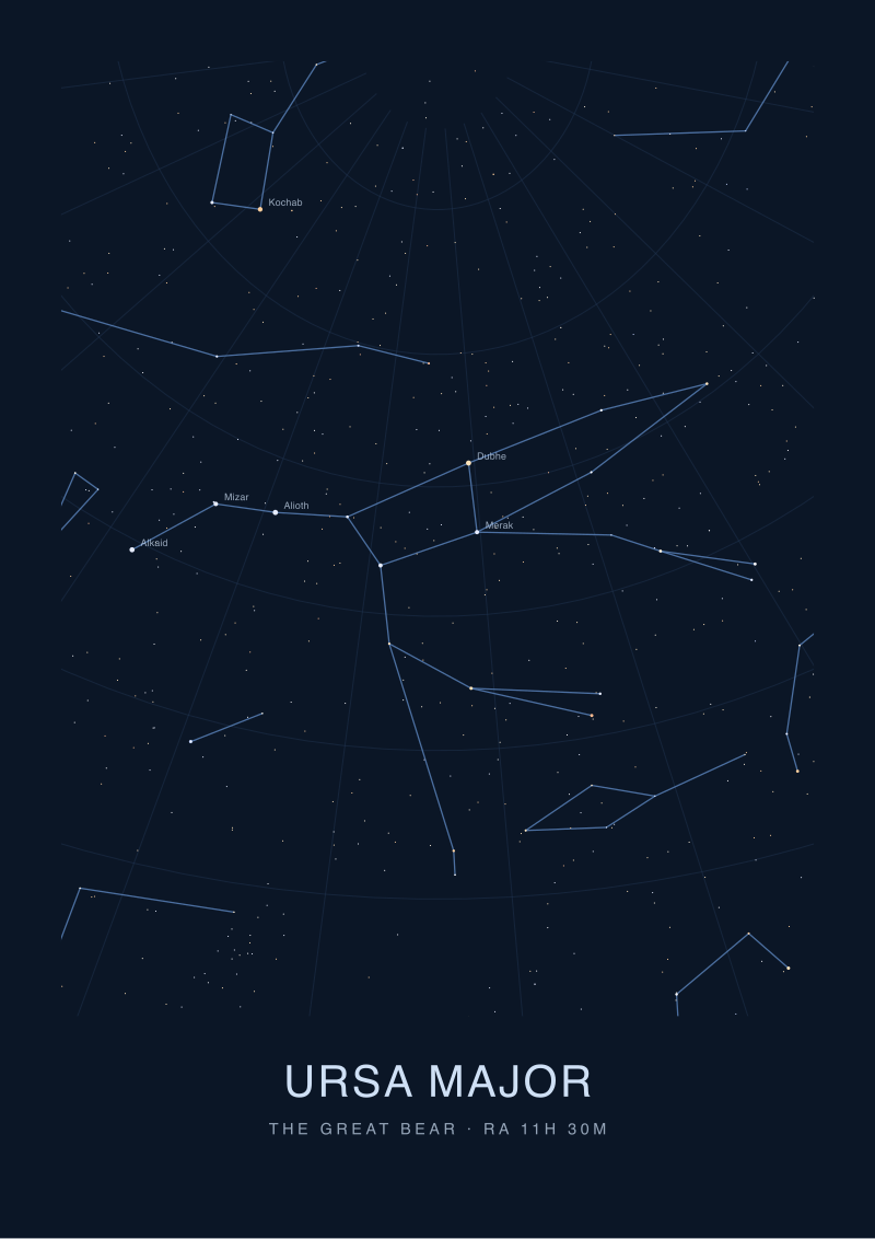 Ursa Major
The print from this article · from €29.95
View the print →
Ursa Major
The print from this article · from €29.95
View the print →
Question 3: How Bright Should a Magnitude 1.85 Star Actually Look on Paper?
The third fork is the one most chartmakers underweight. Magnitude 1.85 is a number, but a dot on paper is a physical object with a diameter in millimetres. Translating one into the other is the least automatic part of drawing a star map, and it is where two charts of the same star can look nothing alike.
The magnitude scale is logarithmic and inverted. A star of magnitude 1.85 is roughly 2.5 times brighter than magnitude 2.85 and roughly 6.3 times brighter than magnitude 3.85. On a naked-eye chart plotting stars down to magnitude 5 or 6, Alkaid is emphatically in the bright cohort — brighter than most of the sky the map contains — but it is not among the very brightest. Sirius, at magnitude −1.46 on the same scale, is more than twenty times brighter to the eye. Alkaid is a strong second-tier star in the visual hierarchy.
If You Want a Linear Scale (Diameter Proportional to Brightness)
Set the dot diameter directly proportional to the linear flux implied by the magnitude. A magnitude 1.85 star gets a dot several times wider than a magnitude 4 star. The visual result is honest to the physics, and it is what technical astronomy charts do — the ones designed to be measured against, not framed.
The problem is that the very brightest stars swell into blobs that overlap the graticule, and the fainter ones vanish into pinpricks smaller than the printer's ink can hold. Linear-flux dots read as a map of a few enormous stars in a field of specks. Legible for astronomers; unlovely on a wall.
If You Want a Perceptual Scale (Diameter Proportional to Log Brightness)
Compress the range. Assign a base dot size to the faintest magnitude the chart shows, then increase the diameter by a fixed step for each whole magnitude of brightness. At magnitude 1.85, Alkaid gets a dot several steps up from the faintest tier but well below the reserved size for magnitude 0 and −1 stars. The step size — typically between 0.5 and 1.0 mm per magnitude on a print at atlas scale — is the single most consequential choice in the map's visual character.
This is what almost every printed star map since the nineteenth century has done, and it is what Sky Atlas prints do. It is a lie to the physics and a truth to the eye. The trade is aesthetic legibility over quantitative fidelity, and for a map that will be looked at rather than measured, the perceptual scale is the correct choice. State the step in the legend so the technically curious reader can back it out.
If You Answered Everything
The three questions produce eight combinations. Every one of them yields a real, valid, publishable map — the differences are editorial, not right-or-wrong. The table below maps the eight routes onto the shape of the artefact each one becomes.
| Q1: Coordinates | Q2: Context | Q3: Magnitude Scale | Recommendation |
|---|---|---|---|
| Catalogue | Point | Linear | Technical single-star reference plate for catalogue verification work. |
| Catalogue | Point | Perceptual | Isolated Alkaid portrait for a study set; the archival default. |
| Catalogue | Line to Mizar | Linear | Precision Plough chart for observers matching field stars to a scope. |
| Catalogue | Line to Mizar | Perceptual | The wall print: recognisable Plough, catalogue-true, perceptually clean. |
| Observed | Point | Linear | Instrument-aiming aid tied to a specific date, latitude, and hour. |
| Observed | Point | Perceptual | Tonight-only single-star finder for a reader learning the northern sky. |
| Observed | Line to Mizar | Linear | Bespoke Plough for a dated star party at a stated location. |
| Observed | Line to Mizar | Perceptual | Souvenir sky-tonight print anchored to a specific evening. |
The eight recommendations are not ranked. A studio like ours defaults to row four — catalogue coordinates, the Plough drawn as context, a perceptual magnitude scale — because that combination is the one most likely to survive framing, hanging, and a decade on a wall without needing a reprint. The observed-coordinate variants have a shorter half-life by design; they belong to a night, not a catalogue.
The three numbers we started with — RA 13.79235h, Dec +49.31327°, magnitude 1.85 — do not change across the eight rows. What changes is how the chart renders them, and the map you end up holding is the answer the chartmaker gave to three questions the star itself does not ask.
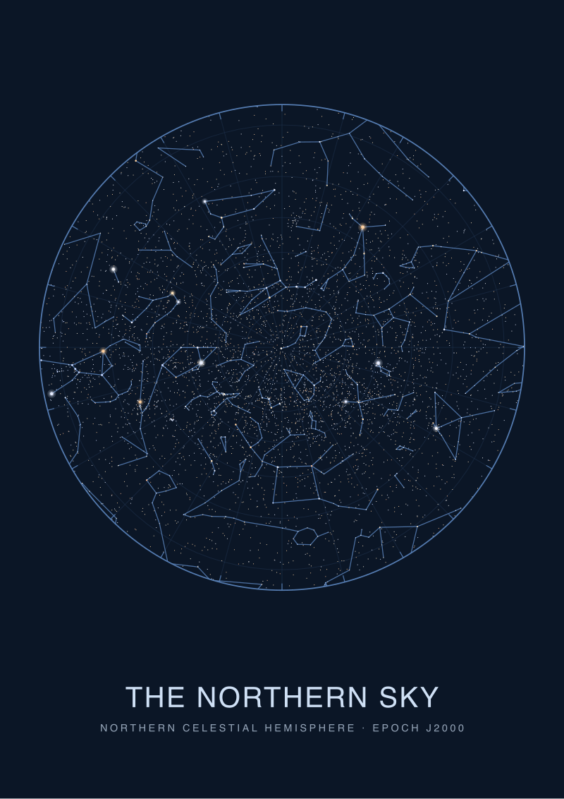 The Northern Sky
The print from this article · from €29.95
View the print →
The Northern Sky
The print from this article · from €29.95
View the print →
FAQ
Why does the HYG catalogue list Alkaid's magnitude as 1.85 rather than a rounder number?
The HYG v41 catalogue records apparent visual magnitudes at the precision the underlying photometric surveys measured them. Alkaid's value of 1.85 comes from those measurements, not from a rounded convention. Rounding to 1.9 or to "second magnitude" is a chart-legend choice, not a catalogue one. Sky Atlas prints the two-decimal value in the technical legend and lets the dot size do the perceptual translation on the map itself.
What does the +49.31327° declination mean for who can see Alkaid?
A declination of +49.31327° places Alkaid firmly in the northern celestial sphere. From any latitude north of roughly +41°, the star is circumpolar — it never sets and traces a small circle around the pole through the night. From equatorial latitudes it rises and sets normally. From most of the Southern Hemisphere it never clears the horizon, which is why the Plough is a northern shape in every sense, cultural and geometric.
Is right ascension in hours really the same kind of coordinate as declination in degrees?
Both are angles, but they use different units for historical reasons. Right ascension is measured in hours, minutes, and seconds because the sky appears to rotate once every 24 sidereal hours, so time-units map cleanly onto east-west position. Declination is measured in degrees because it is a straight angular distance from the celestial equator. Alkaid's 13.79235 hours equals 206.885 degrees of RA; the hour form is convention, not necessity.
Why is Alkaid drawn at the tip of the Plough's handle rather than the base?
The Plough is oriented with its bowl toward Dubhe and Merak and its handle curving out through Alioth, Mizar, and terminating at Alkaid. This is a geometric fact of where the seven stars sit relative to each other in the sky — Alkaid's coordinates place it the furthest east-north-east of the seven, at the end of the arc. The name "Alkaid" comes from Arabic naming heritage, where the star was described as the leader of a funeral procession trailing behind the bier — a lore reading, told as lore.
Does Alkaid belong to the same physical group as the other Plough stars?
This is a question the catalogue alone cannot settle, and one Sky Atlas answers cautiously. Five of the seven Plough stars share a common motion through the galaxy and are considered part of the Ursa Major Moving Group. Alkaid and Dubhe are the two exceptions — they are not part of the group despite sitting in the asterism the eye connects. The Plough is partly a physical association, partly a coincidence of sightlines.
What is the difference between a constellation and an asterism on the map?
A constellation is one of the 88 regions the International Astronomical Union agreed to in 1930 — a bounded patch of sky with a name and formal borders. Ursa Major is a constellation. The Plough, or Big Dipper, is an asterism: a recognised shape formed by a subset of stars inside or across constellations, with no official IAU status. Alkaid is a star in the constellation UMa and also the tail-end of the Plough asterism.
Can I use the Alkaid coordinates from this article to point a telescope?
The coordinates are accurate to catalogue precision at the J2000.0 equinox, which is the standard HYG reference frame. For most amateur telescope work — go-to mounts, plate-solving software, star-hopping from an atlas — these values are more than sufficient; the instruments themselves apply precession corrections to the date of observation. Professional-grade astrometry requires you to also account for proper motion, aberration, and refraction, none of which are encoded in a single catalogue snapshot.
Where can I get a print of the Alkaid map described here?
Sky Atlas prints the row-four map — catalogue coordinates, the Plough drawn as context, perceptual magnitude scale — as part of our northern-sky series, available in the studio shop. Each print carries the epoch, the magnitude step, and the constellation legend in the margin, so the reader can read the chart as a chart, not only as a picture.
From the collection
New charts and 10% off your first print.
One email now with your code. No noise after.