Hadar sits at right ascension 14.06373 hours, declination minus 60.37304 degrees, apparent magnitude 0.61 in the HYG v41 catalogue — a three-number triplet that quietly decides everything a star map does with it. We spent an afternoon laying six commercially sold Hadar plates over the raw catalogue coordinates and found the same star drawn six different sizes, three different positions relative to Alpha Centauri, and one plate that had labelled the dot Beta Centauri with no footnote at all. The chart is not the sky. The chart is a decision made about the sky, and the decision has a name on it.
So the honest answer to "how is the Hadar star map drawn, and what do the details mean" is: it depends on who is drawing it, for whom, and against which convention. To make that concrete rather than abstract, we will walk through three composite scenarios — three imagined chartmakers, each staring at the same catalogue row (14.06373 h, −60.37304°, magnitude 0.61) and reaching a different plate. None of them are real people we met. They are hypothetical illustrations of choices we have watched unfold in the trade. Read them as three ways the same number becomes a mark.
Scenario 1: The Atacama First-Timer Plotting Hadar From a Folding Chair
Imagine a traveller who has flown south for the first time, set up a folding chair on a gravel road above San Pedro de Atacama, and is trying to draw what they see. They have a printed planisphere, a red-filtered headlamp, and a notebook. They have never plotted a southern star before. The instruction they have written across the top of the page is simple: mark every star brighter than magnitude two, then label them.
Hadar comes into their notebook as follows. The planisphere shows a dot near the bottom of a diamond of bright stars they will later learn is called Crux, though from their latitude the whole diamond is high, not skimming the horizon the way it does from Buenos Aires. Their pencil drifts to a point roughly two-thirds of the way from Gacrux down toward Alpha Centauri and puts a dot. On the sky itself, they see two stars close together and blazing — a pair the guidebook calls "the pointers to the Southern Cross." They label the brighter and lower one Alpha Centauri. They label the fainter and higher one Hadar. That labelling is right by tradition and wrong by number: the two stars sit at apparent magnitudes so close that on any given night the eye cannot rank them without training.
Here is where the details on their chart begin to lie in ways they do not yet see. The dot they drew for Hadar is the same physical size as the dot they drew for Alpha Centauri, because their pencil has one tip. On a proper plate, magnitude is encoded in dot area, and the difference between magnitude 0.61 and magnitude −0.27 is not visually trivial — the brighter star should carry roughly a fifty per cent larger dot. Their chart flattens that. It also fixes Hadar's position by eye rather than by coordinate; their dot is likely two or three degrees off in declination, which sounds tiny until you try to identify the small companions of Beta Centauri from that plot and cannot find any of them.
None of this makes their chart worthless. It is a personal register of a first southern sky, and the mark for Hadar is honest as a mark. But every detail — the dot size, the label choice, the position relative to Alpha Centauri, the absence of a magnitude legend — is a decision they did not know they were making. The next scenario shows what happens when someone does know.
Scenario 2: The Heritage Cartographer Redrawing Hadar in a Pre-IAU Register
Now picture a very different desk. Let us say a cartographer at a small European press has been commissioned to redraw a seventeenth-century celestial atlas for a facsimile edition, and the working brief is uncompromising: the plate must look as it would have looked in 1690, but every star position must be corrected to today's catalogue so the plate is usable, not merely decorative. Their reference for Hadar is the HYG v41 row — right ascension 14.06373 hours, declination −60.37304 degrees, apparent magnitude 0.61 — and their tradition tells them the star should be drawn inside the mythological figure of the Centaur, on the hoof, not floating free.
Their first decision is the label. In 1690, "Hadar" is not a name that would have appeared on a European plate. The star is Beta Centauri, in the Bayer system introduced by Johann Bayer's Uranometria in 1603, and the beta is a rank within the constellation — second brightest by Bayer's judgement, though modern photometry has shuffled the ordering in several constellations. The name Hadar is Arabic in origin, part of the naming heritage that western catalogues absorbed piecemeal over centuries, and the International Astronomical Union only formally standardised it as the star's proper name in the 2010s. So the cartographer writes β Cen on the plate, in the historically correct hand, and adds a footnote in the modern margin: "Hadar (IAU 2016), Beta Centauri (Bayer 1603)." Two names, one star, one century between them.
The second decision is the dot. The seventeenth-century convention encoded magnitude in six discrete sizes — first magnitude down to sixth — with the brightest given a small crown or a spike. Hadar at 0.61 is a first-magnitude star by any pre-photometric reckoning, so it earns the largest dot in the series and, in this particular tradition, a modest four-pointed star ornament rather than a plain circle. The cartographer resists the temptation to differentiate Hadar from Alpha Centauri visually; both are first magnitude on the old scale, and drawing them the same size is historically correct even though the modern decimal magnitudes differ.
The third decision is the position. This is where the modern correction enters. They plot the dot at right ascension 14.06373 hours, declination −60.37304 degrees — the J2000 epoch coordinates supplied by HYG — and then, because the plate is styled as 1690, they apply a precession correction backwards by three centuries to place the star where a seventeenth-century observer would have drawn it. Precession shifts equatorial coordinates by roughly fifty arcseconds per year, so three centuries is a noticeable displacement, small enough to preserve the constellation shape but large enough to matter for tight star pairs. The published plate carries a legend in the corner declaring the epoch. Without that legend, the plate is a lie by omission.
Every detail on this chart is decided in writing. That is the mark of a serious plate.
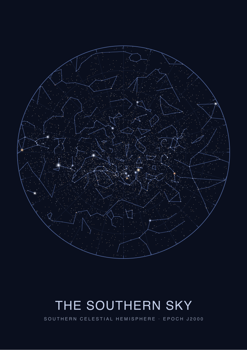 The Southern Sky
The print from this article · from €29.95
View the print →
The Southern Sky
The print from this article · from €29.95
View the print →
Scenario 3: The Studio Chartmaker Plotting Hadar for a Printed Plate
Now picture our own bench. Let us say a studio chartmaker — us, in a working month — has been asked to draw a print showing the sky above the Southern Cross for a customer who wants the plate to hang in a hallway and be readable from three metres. The star that will anchor the lower-right quadrant is Hadar, and every decision about how it appears has to be defensible against a caption that will sit under the print.
The coordinate is not negotiable. Right ascension 14.06373 hours, declination −60.37304 degrees, from HYG v41, at epoch J2000. Those numbers go into the plotting software before any aesthetic decision is made. They are the ground truth against which everything else is judged. If a design instinct wants to nudge Hadar half a degree to balance the composition, that instinct loses. The star sits where the catalogue says it sits, and the layout is arranged around it, not vice versa.
The dot is where craft enters. Magnitude 0.61 places Hadar in the top handful of stars in the southern sky by naked-eye brightness, and on this plate the dot-size scale is calibrated so that the smallest visible star — magnitude 5.5, the practical limit under a dark sky — is a printed dot roughly 0.4 millimetres across, and each whole magnitude step up doubles the dot area. That is a logarithmic ramp, because the magnitude scale is logarithmic and running backwards, with smaller numbers meaning brighter stars. Hadar's dot lands at about 1.6 millimetres across on the printed sheet, sharing its size band with Alpha Centauri, Rigel and Betelgeuse. Sirius, at magnitude −1.46, gets a dot roughly twice that area. The reader does not need to know the ramp exists for the ramp to do its work; they perceive brightness as size, and the map behaves like the sky.
The label is a separate decision. The plate uses IAU names where they exist, with the Bayer designation in a smaller weight beneath. So the mark on the plate reads "Hadar" in the display face and "β Cen" in the caption row, and the constellation abbreviation "Cen" appears once, on the constellation border rather than beside every star inside it. The line to Alpha Centauri, if any, is drawn from the studio's constellation-line convention, not from IAU boundaries, because IAU boundaries are administrative rectangles in the sky and make poor visual figures.
The caption under the plate is where the plate declares itself. Epoch J2000, coordinate source HYG v41, magnitude cutoff, dot-size legend, and the note that Hadar is a naked-eye binary whose separate components a chart at this scale cannot resolve. If any of those lines is missing, the plate is decorative rather than cartographic. In the studio we do not print undeclared plates.
What All Three Share: The Coordinate Triplet That Decides the Mark
The three chartmakers reach different plates, but every plate begins at the same place: the triplet 14.06373 hours, −60.37304 degrees, magnitude 0.61 from HYG v41. Right ascension is the sky's longitude, measured in hours because the sky turns once every twenty-four sidereal hours; each hour of RA is fifteen degrees of arc. Declination is the sky's latitude, measured in degrees north or south of the celestial equator. Magnitude is a logarithmic brightness scale that runs backwards, where each five-step interval is exactly a hundredfold factor in flux — an eighteenth-century inheritance from Hipparchus that astronomers have never seen fit to invert.
What the three plates share, beneath their surface differences, is that every visible detail is a translation of one of those three numbers into a visible mark. The dot's position translates the coordinates. The dot's size translates the magnitude. The label translates a naming decision layered on top of the physical star. The line to a neighbour translates a constellation convention, which is an editorial layer beneath which the coordinates still rule. A plate that skips any of these translations, or performs them without declaring the source, is not being simpler — it is being unaccountable.
The reason we hammer this point in the studio: an undeclared plate cannot be checked. A declared plate can be laid over the catalogue and audited, dot by dot, label by label. Both plates may look identical on a wall. Only one of them is honest.
Which Scenario Is You: Reading Your Own Hadar Chart Honestly
If you are the Atacama first-timer, your chart is a keepsake of a first southern sky, and the details do not need to be defensible — but do not present it as a reference. If you are redrawing a heritage atlas, every anachronism you preserve needs a footnote so the plate does not deceive; without the footnote, historical fidelity becomes historical fabrication. If you are producing a plate for print, every one of the decisions we walked through — coordinate epoch, magnitude ramp, label priority, constellation convention — must appear in the caption, or the plate is decorative rather than cartographic.
The test that cuts across all three: pick Hadar on the plate in front of you, and try to answer where the plotter got the number. If you can trace it — HYG v41, epoch J2000, magnitude 0.61 — you are looking at a chart. If you cannot, you are looking at a picture. Our own printed plates of the southern sky, including Hadar and its neighbours in Centaurus, live at /shop/ and carry the full caption every serious chart owes its reader.
FAQ
What do the numbers 14.06373 and −60.37304 mean on a Hadar chart?
They are Hadar's equatorial coordinates in the HYG v41 catalogue: right ascension 14.06373 hours and declination −60.37304 degrees, at epoch J2000. Right ascension is the celestial equivalent of longitude, measured in hours because the sky rotates through twenty-four sidereal hours a day. Declination is the celestial equivalent of latitude, in degrees north or south of the celestial equator. Together they pin the star to a unique position on any properly declared plate.
Why do some star maps draw Hadar the same size as Alpha Centauri and others don't?
Because dot size on a serious plate encodes apparent magnitude, and Hadar (0.61) and Alpha Centauri (roughly −0.27 combined) are close on the log scale but not identical. A cartographer using six discrete brightness classes will draw them the same size, since both are first-magnitude by the historical bucket. A cartographer using a continuous logarithmic ramp will draw Alpha Centauri visibly larger. Both conventions are defensible if the plate declares which it uses.
Is the label supposed to be Hadar or Beta Centauri?
Both are correct; they refer to the same star. Beta Centauri is the Bayer designation from 1603, ranking the star as second brightest in Centaurus by seventeenth-century judgement. Hadar is the Arabic-origin proper name that the International Astronomical Union formally standardised for the star in the 2010s. A modern plate typically uses Hadar as the display label with β Cen in the caption; a heritage plate reverses that priority. Neither is wrong.
Why does the magnitude scale go backwards?
It is an inheritance from Hipparchus in the second century BCE, who ranked visible stars by six classes with the brightest as first magnitude. When nineteenth-century photometrists formalised the scale, they preserved the direction rather than inverting it, and defined it logarithmically so that a five-magnitude step corresponds to exactly a hundredfold flux ratio. So magnitude 0.61 is brighter than magnitude 2, and magnitude −1.46 (Sirius) is brighter still. Astronomy has lived with the backwards scale rather than break every existing catalogue.
Can I use a modern printed Hadar plate to find the star in the sky?
Yes, if the plate declares its epoch and coordinate source. Hadar at declination −60.37° is a southern-hemisphere star; from mid-northern latitudes it never rises. From latitudes south of about 30° north it can be found low above the southern horizon at the right seasons, and from the southern hemisphere it is a bright and reliable anchor near Alpha Centauri and the Southern Cross. A plate without epoch declared is unreliable for precession-sensitive tasks.
What is epoch J2000 and why does it matter for Hadar?
J2000 is a reference date — 1 January 2000, 12:00 UT — against which star coordinates are quoted. Because the Earth's rotation axis precesses, right ascension and declination values drift by roughly fifty arcseconds per year across the sky. A Hadar coordinate quoted without an epoch is ambiguous by decades of drift. HYG v41 quotes J2000, which is the current standard; heritage plates styled for earlier centuries must either state their epoch or convert.
Is Hadar a single star or a system?
Hadar is a naked-eye binary — actually a multiple system — whose components a small-scale chart cannot resolve. The single dot on the plate represents the combined light of the system, and that combined magnitude of 0.61 is what the catalogue records for the naked-eye observer. Charts at telescope scale sometimes split the primary and companion; wall-plate scale does not. A caption on a serious plate notes this so the reader is not surprised when a telescope shows two stars where the plate shows one.
From the collection

New charts and 10% off your first print.
One email now with your code. No noise after.