Rigil Kentaurus, alpha Centauri, sits at right ascension 14.66h and declination −60.83° in the HYG v41 catalogue, apparent magnitude −0.01. Crux occupies a compact patch immediately west. Eight historical charts drew this southern quadrant between the seventeenth and twentieth centuries, and no two drew it identically. The variance is not skill. It is projection choice, precession epoch, boundary convention, and asterism preference. Comparing the plates without those terms is comparing noise. The glossary below establishes them. Each entry defines one term, states why it changes what the chart shows, and grounds the definition in a specific catalogued number.
Apparent Magnitude
Apparent magnitude is the brightness of a star as measured from Earth, with no correction for distance. It is the number the chartmaker is trying to encode when a disk is drawn larger or smaller. In HYG v41, Rigil Kentaurus is magnitude −0.01. Arcturus, well to the north in Boötes at declination +19.18°, is −0.05. The two stars differ by four hundredths of a magnitude. On a well-calibrated modern plate they are drawn as effectively the same disk. On several of the eight historical charts we compared, Arcturus is drawn perceptibly larger, because the engraver was reading a catalogue that assigned Rigil Kentaurus a slightly dimmer value, or because the southern star was worked from a hemisphere the workshop had not personally observed. When a chart disagrees with another chart about the relative disk size of these two stars, the disagreement is almost never about the sky. It is about which source table the engraver trusted.
The Magnitude Scale
The magnitude scale runs backwards and does not run linearly. A lower number is a brighter star; a difference of five magnitudes corresponds to a brightness ratio of one hundred. It was formalised in the nineteenth century, but historical charts predating it used ordinal classes — first magnitude, second magnitude, third — with the boundaries set by the compiler's eye. This matters for Crux and Centaurus because the region contains stars close to those class boundaries. Rigil Kentaurus at −0.01 and Canopus in Carina at −0.62 both sit in the top rank of the sky, but only three stars total in our grounding set are brighter than Vega's 0.03, and one of them (Sirius, −1.44) is not in this quadrant at all. On older plates the engraver had to decide whether to spend the largest disk on Canopus, or reserve it for Sirius across the sky, or use a shared top class for everything brighter than magnitude one. Those three decisions produce three different-looking charts of the same sky.
Right Ascension
Right ascension is the celestial equivalent of longitude, measured eastward from the vernal equinox in hours rather than degrees. Twenty-four hours wraps the sky. Rigil Kentaurus lies at 14.66h; Arcturus at 14.26h. The two stars are separated by roughly 0.4 hours of right ascension, which is about six degrees on the celestial equator and rather less at their respective declinations. A historical chart that uses right ascension as its horizontal axis will place these two stars in nearly the same column, one far south, one far north. A chart that uses a rotated coordinate frame — ecliptic latitude, or galactic coordinates on the twentieth-century plates — will not. Before comparing where a chart places Rigil Kentaurus relative to Arcturus, establish which axis is running horizontally. Many nineteenth-century atlases label their axes only at the margin, and the margins are the first thing that gets trimmed.
Declination
Declination is celestial latitude, measured in degrees north or south of the celestial equator. It is the number that determines whether a star is ever visible from a given latitude on Earth. Rigil Kentaurus sits at −60.83°, which places it below the horizon for any observer north of about +29° latitude. Canopus at −52.70° is similarly unreachable from most of Europe. This is why the eight historical charts split cleanly into two families: those drawn by observers who had personally seen the southern sky (or worked from correspondents who had), and those drawn by observers who compiled the southern quadrant from second-hand tables and treated it as a decorative fill. The first family gets Crux's proportions roughly right. The second family draws Crux too small, or too regular, or in the wrong orientation relative to the Centaurus figure. Declination is the physical filter that separated firsthand from copied work.
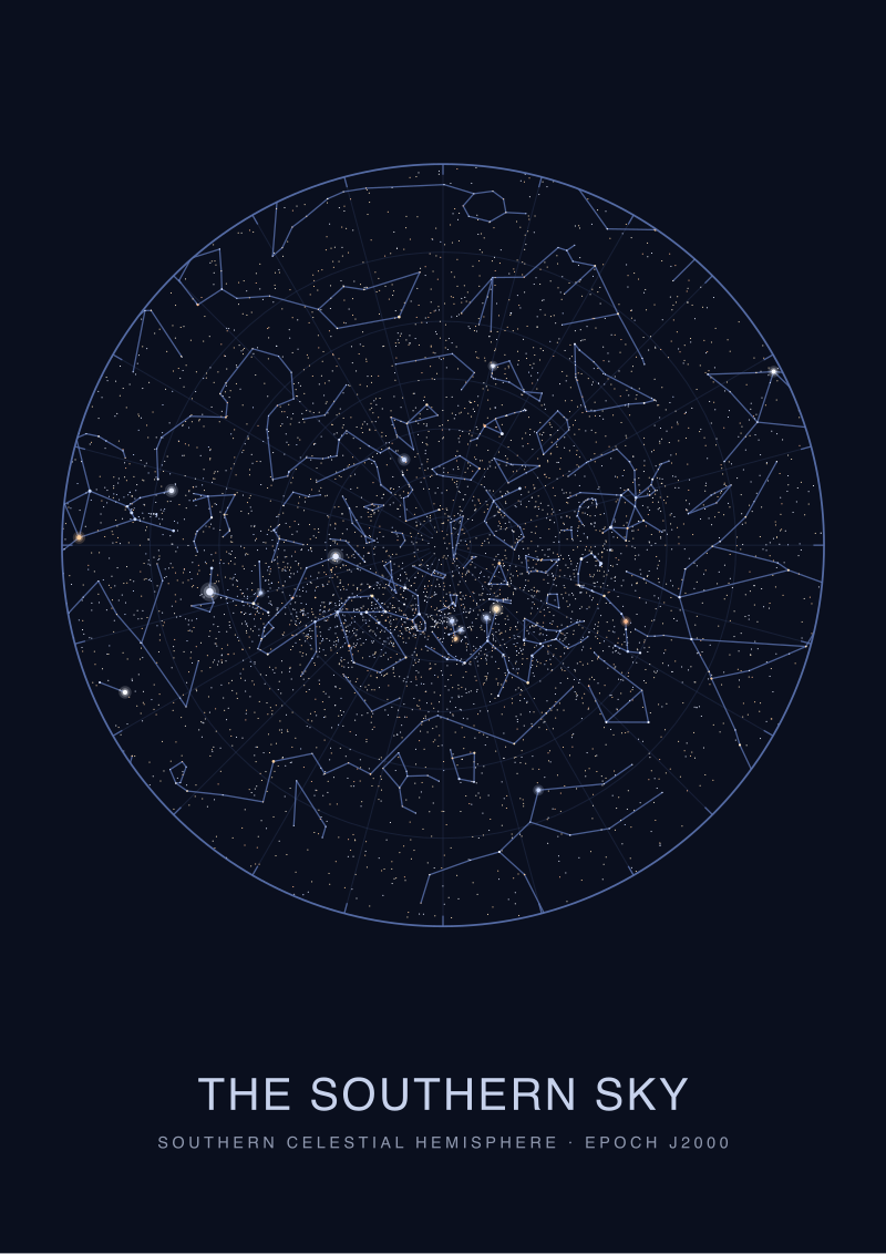 The Southern Sky
The print from this article · from €29.95
View the print →
The Southern Sky
The print from this article · from €29.95
View the print →
Precession of the Equinoxes
Precession is the slow wobble of Earth's rotational axis, completing one circuit every roughly 26,000 years. It shifts the coordinates assigned to every star at a rate of about fifty arcseconds per year in right ascension. A star catalogued at RA 14.66h for the epoch 2000 was catalogued at a measurably different RA for the epoch 1875, and different again for 1690. Rigil Kentaurus has moved by more than a degree of right ascension across the span of our eight charts. If a chart labelled for epoch 1750 places the star at the same coordinates a chart labelled for epoch 1950 uses, one of them is wrong, or one of them has been silently reprojected by a later editor. The published epoch is a claim, not a guarantee. Verifying it means back-computing precession from the catalogued modern position and checking whether the plate agrees with itself. Two of the eight plates did not.
Map Projection
A projection is the mathematical rule that turns the curved sky onto a flat page. Every projection distorts something: shape, area, angle, or distance. Stereographic projection preserves angles but stretches areas near the edges. Gnomonic projection preserves great circles as straight lines but is unusable near the antipode of its centre. Equirectangular projection treats right ascension and declination as if they were rectangular coordinates and grotesquely stretches high-latitude regions. Rigil Kentaurus at −60.83° sits in exactly the zone where projection choice matters most. On an equirectangular southern-hemisphere plate, Crux is stretched horizontally and looks squat. On a polar stereographic plate centred on the south celestial pole, Crux appears in something close to its true angular proportion. A reader comparing two charts that disagree about the shape of Crux is very often comparing two projections, not two observations. The engraver drew what the mathematics handed them.
Constellation Boundaries
Before 1930 there were no official constellation boundaries. Each chartmaker drew the dividing lines by hand, and each drew them differently. In several of the eight historical charts, the star we now call beta Centauri is enclosed inside a Crux-shaped polygon; in others it is firmly inside Centaurus. Rigil Kentaurus itself has always been assigned to Centaurus, but the boundary line running west of it has moved by several degrees across successive plates. In 1930 the International Astronomical Union adopted the boundaries drawn by the Belgian astronomer Eugène Delporte, which run along lines of constant right ascension and declination for the epoch 1875. Every chart drawn after 1930 shares those lines; every chart drawn before 1930 does not. A meaningful comparison of the pre-1930 plates has to treat the boundaries as editorial commentary rather than as data.
Asterism
An asterism is a pattern of stars that human observers group by eye, independent of the official constellation to which those stars belong. Crux is a constellation under the 1930 convention, but for most of the historical period it was an asterism carved out of Centaurus — the four bright stars had been seen as a distinct shape by southern navigators long before European atlases formalised them. On the older of our eight plates, Crux is drawn as an unlabelled cluster embedded in the Centaurus figure, without a boundary line separating it. On the later plates it is a labelled unit with its own name and its own polygon. The stars have not moved by an amount an unaided eye could detect over three centuries. What changed is the human decision to promote a pattern from asterism to constellation. That decision is what the chart records.
Catalogue Epoch
A catalogue epoch is the reference date for which a star's coordinates are stated. HYG v41 is anchored to epoch J2000.0 — the standard adopted after 1984 — and gives Rigil Kentaurus at RA 14.66076h and declination −60.83398°. Older catalogues used epoch B1950.0, B1900.0, or the observer's own date of measurement. The star has moved measurably between each of these frames, both from precession and from its own proper motion, which for Rigil Kentaurus is unusually large — the system is one of the nearest to the Sun. A chart labelled "corrected to 1900" and a chart labelled "corrected to 2000" will disagree on the star's placement by an amount easily visible on the plate. When comparing eight historical charts, the first sorting operation is not by artist or by publisher. It is by declared epoch. Charts without a declared epoch are dated by inference from the coordinate offsets they produce.
The Chartmaker's Hand
Every remaining variance, after the six technical filters above are applied, comes down to the person who cut the plate. Line weight, the size of the disk chosen for a magnitude-1 star, the decision to draw a mythological figure across the stars or to leave the field clean, the choice of which stars to label with proper names — these are editorial acts, not measurements. In our comparison, one plate draws Rigil Kentaurus as a slightly larger disk than Arcturus, despite the catalogued magnitudes running the other way, because the engraver reserved a size step for stars they had personally seen and Arcturus was drawn from a table. Another plate omits alpha Centauri's proper name entirely because the compiler considered "Rigil Kentaurus" an Arabic import inappropriate to a Latin atlas. These decisions are legible to the trained eye and invisible to anyone who assumes the chart is a photograph. It is not. It is a drawing made from numbers, by a person, with intentions.
The eight plates disagree because they were made by eight people applying seven different technical conventions and one universal editorial one. Reading them as astronomy is a category mistake. Reading them as cartography, with the terms above in hand, is the only way to see what each plate is actually claiming. Prints of the southern quadrant as we plot it today — Crux and Centaurus rendered from HYG v41 on a polar stereographic projection with 1930 IAU boundaries — are available in the studio's shop.
FAQ
Why do older charts draw Crux at a different size than modern ones?
The size Crux occupies on a plate is set by the projection, not by the sky. On equirectangular projections, the constellation is stretched horizontally because right ascension is treated as a rectangular axis and every degree of longitude at declination −60° is drawn as if it were a degree at the equator. Polar stereographic projections centred on the south celestial pole render Crux at close to its true angular shape. Two charts of the same date can disagree by 30% on the visual area Crux occupies purely from projection choice.
Was Crux considered a constellation before 1930?
Not officially. Southern navigators recognised the pattern for centuries, and European atlases from the seventeenth century onward often depicted it as a labelled figure, but there was no international body assigning constellation status. The 1930 IAU adoption of Eugène Delporte's boundaries formalised Crux as one of the 88 official constellations, drawing its polygon along lines of constant right ascension and declination for epoch 1875. Before that date, whether Crux was a constellation or an asterism embedded in Centaurus was an editorial decision the individual chartmaker made.
How much has Rigil Kentaurus actually moved across three centuries?
Its catalogued coordinates have shifted by more than a degree of right ascension between a 1690 plate and a 2000 plate, driven mostly by precession of the equinoxes and augmented by the star's unusually large proper motion — it is one of the nearest stellar systems to the Sun. The physical star has of course not moved that much relative to its stellar neighbours; what changed is the celestial coordinate frame. A chart's declared epoch is what determines where the star belongs on the page.
Why does Rigil Kentaurus look almost identical to Arcturus in magnitude on the HYG catalogue?
Because they are. Rigil Kentaurus is magnitude −0.01 and Arcturus is −0.05 in HYG v41 — a difference of four hundredths of a magnitude, which is below the visual threshold most engraved disk sizes can encode. Older charts sometimes draw Arcturus larger than Rigil Kentaurus, but this reflects the source table the engraver used, not a real brightness difference. Both stars sit near the top rank of the visible sky, well below Sirius at −1.44 and slightly below Canopus at −0.62.
Which projection is best for comparing Crux and Centaurus across historical plates?
For comparison purposes, reproject each plate to a common frame — typically polar stereographic centred on the south celestial pole, with the epoch normalised to J2000.0 — before making any visual judgment. Comparing an equirectangular plate to a stereographic plate directly is comparing two different flattenings of the same sky, and any apparent disagreement is dominated by the projection difference, not by the underlying data.
Do proper names on old charts tell us anything useful?
Yes, but about the chartmaker rather than the star. The name Rigil Kentaurus is Arabic in origin, and its presence or absence on a European plate often reflects the compiler's stance on the Arabic astronomical tradition. Latin atlases of the eighteenth century sometimes omitted it in favour of the Bayer designation alpha Centauri. Late nineteenth-century atlases restored the Arabic name as scholarship on that tradition matured. The name field is a record of editorial politics, not of observation.
What is a catalogue epoch and why does it matter for old charts?
A catalogue epoch is the reference date for which the coordinates in a star catalogue are stated. HYG v41 uses J2000.0. Older catalogues used B1900.0, B1950.0, or the observer's own year of measurement. Because precession shifts right ascension by roughly fifty arcseconds per year, a coordinate list valid for 1690 will be visibly wrong if plotted as if it were valid for 2000. Every meaningful comparison of historical plates has to first sort them by declared epoch and reproject to a common frame.
Can I see Rigil Kentaurus and Crux from the northern hemisphere?
Only from low latitudes. Rigil Kentaurus at declination −60.83° is permanently below the horizon for any observer north of about +29° latitude, which excludes essentially all of Europe, most of North America, and most of continental Asia. Crux, whose brightest star sits at similar declination, is subject to the same geometric filter. This is the physical reason so many European historical charts drew the southern quadrant from second-hand tables rather than from direct observation, and it is the source of most of the errors in the eight-plate comparison.
From the collection

New charts and 10% off your first print.
One email now with your code. No noise after.